 EN
EN  ES
ES 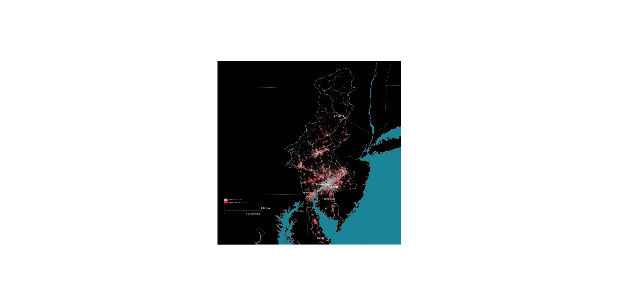
SUSTAINABLE DEVELOPMENT GOALS
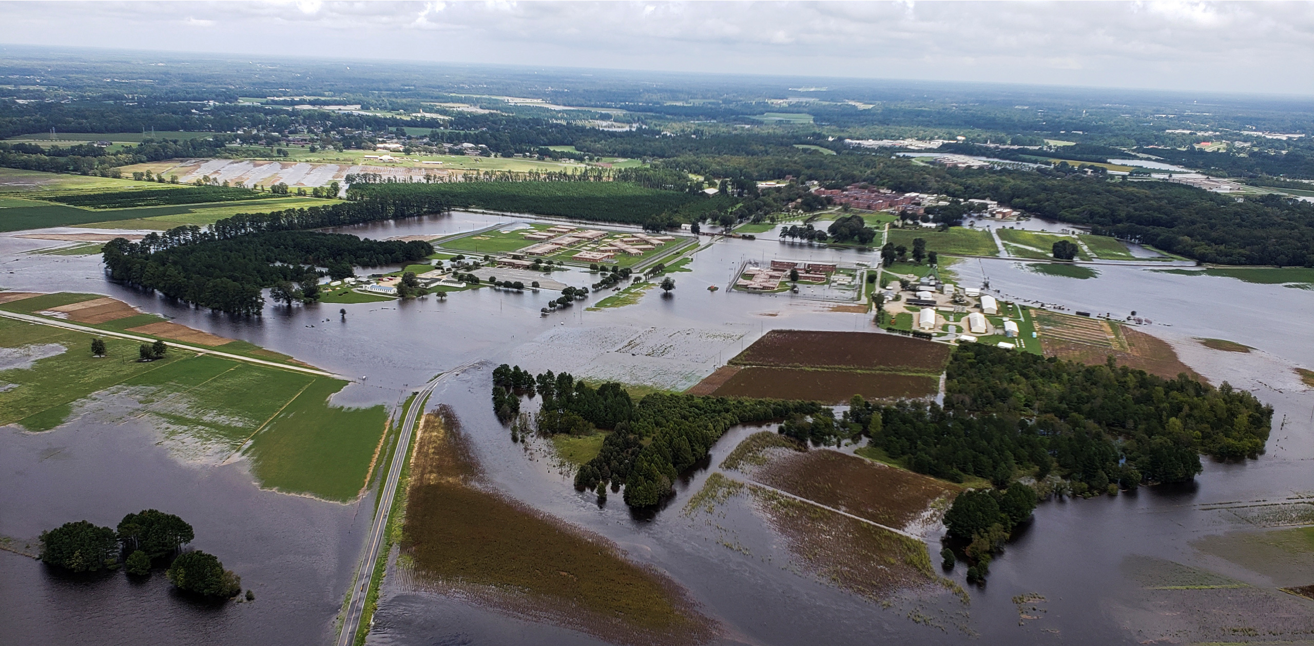
CLIMATE CHANGE
IMPACTS & RESPONSES IN THE DELAWARE RIVER BASIN
AREA: 13,529 mi²
SUBJECT: Sustainable Urban Development & Design, GIS Analysis & Urban Strategies, Climate Change
CLIENT: Delaware River Basin Commission
KEY PERSONNEL: David Yim, City Planning UD Studio-UPenn
LOCATION: New York, New Jersey, Pennsylvania,
and Delaware. From the confluence of the East and West
branches in Hancock, NY to the mouth of the River at the
Atlantic Ocean, the Delaware extends over 300 miles. Several
cities lie along its banks, most notably Wilmington, DE,
Philadelphia, PA, and Trenton, NJ.
SCOPE: GIS Analysis of The Delaware River Basin; Climate Change Threats; Regional Issues; Site-Specific Adaptation; An Agenda for the Region
STATUS: Research Project
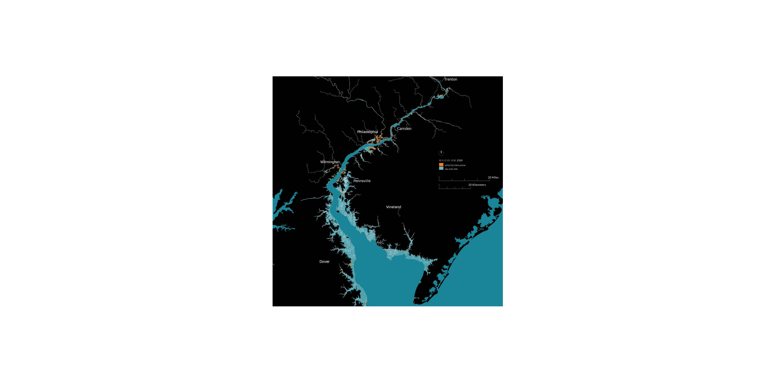
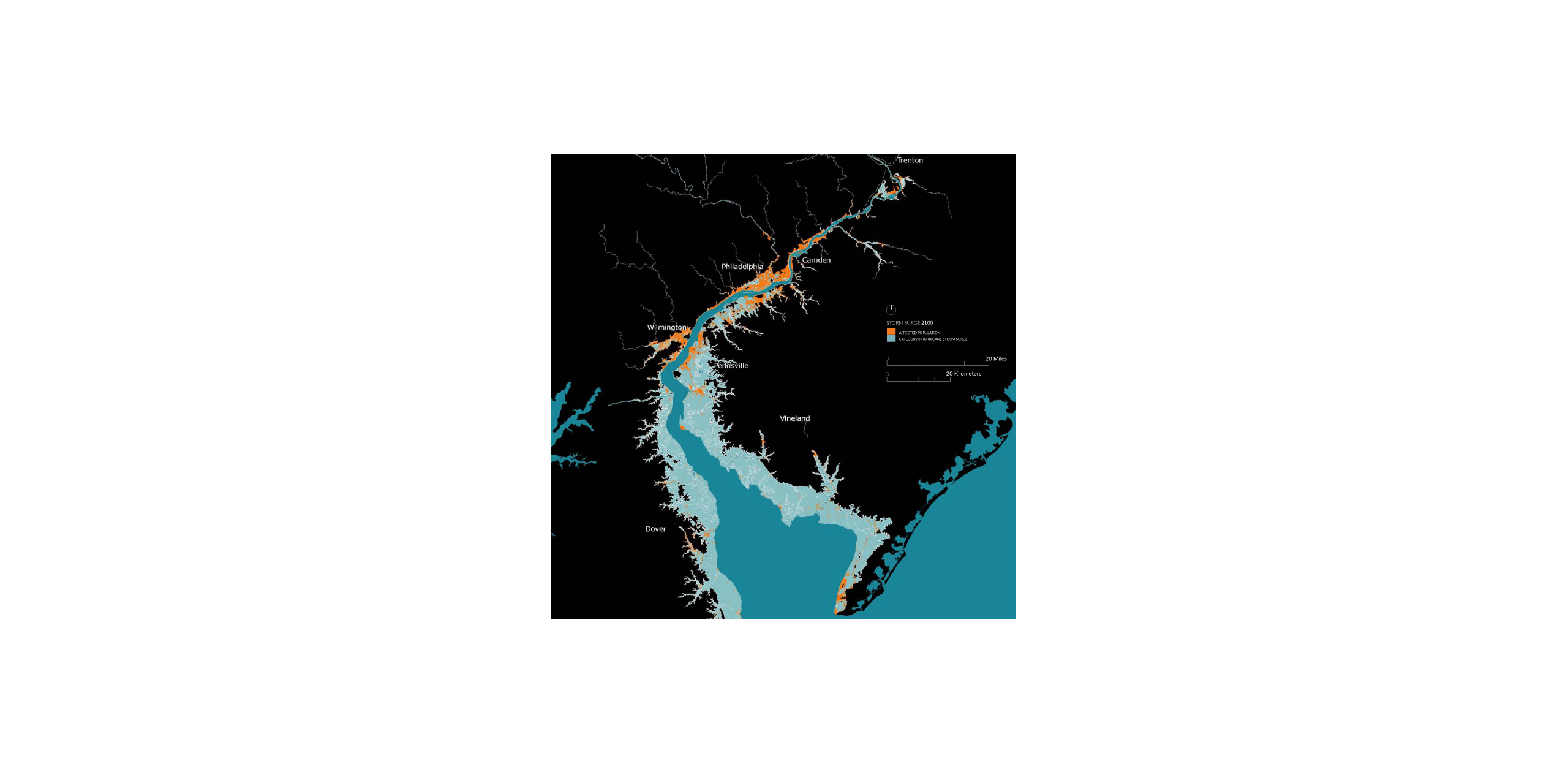
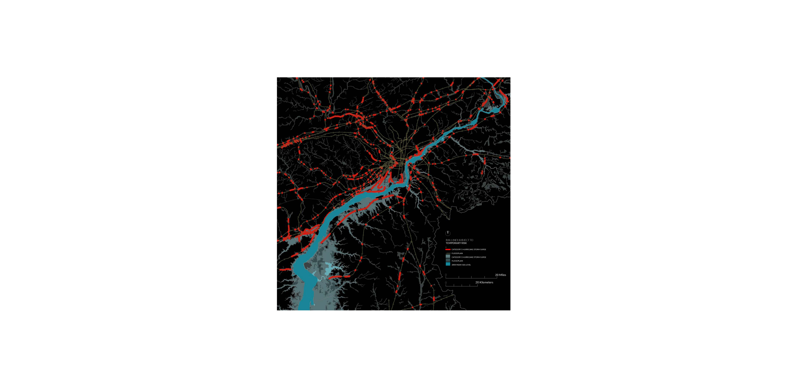
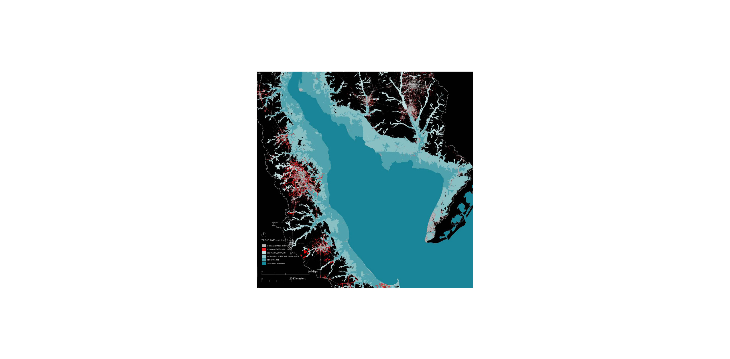
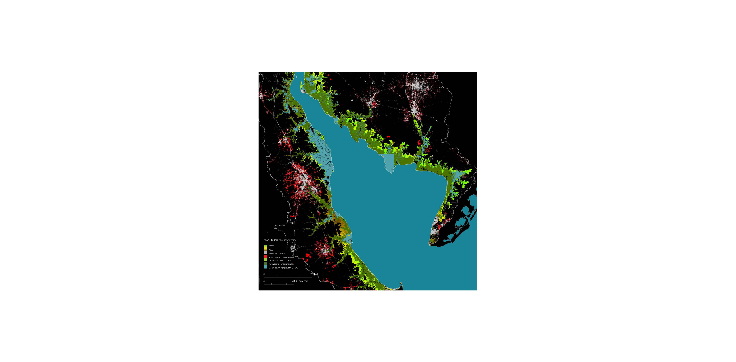
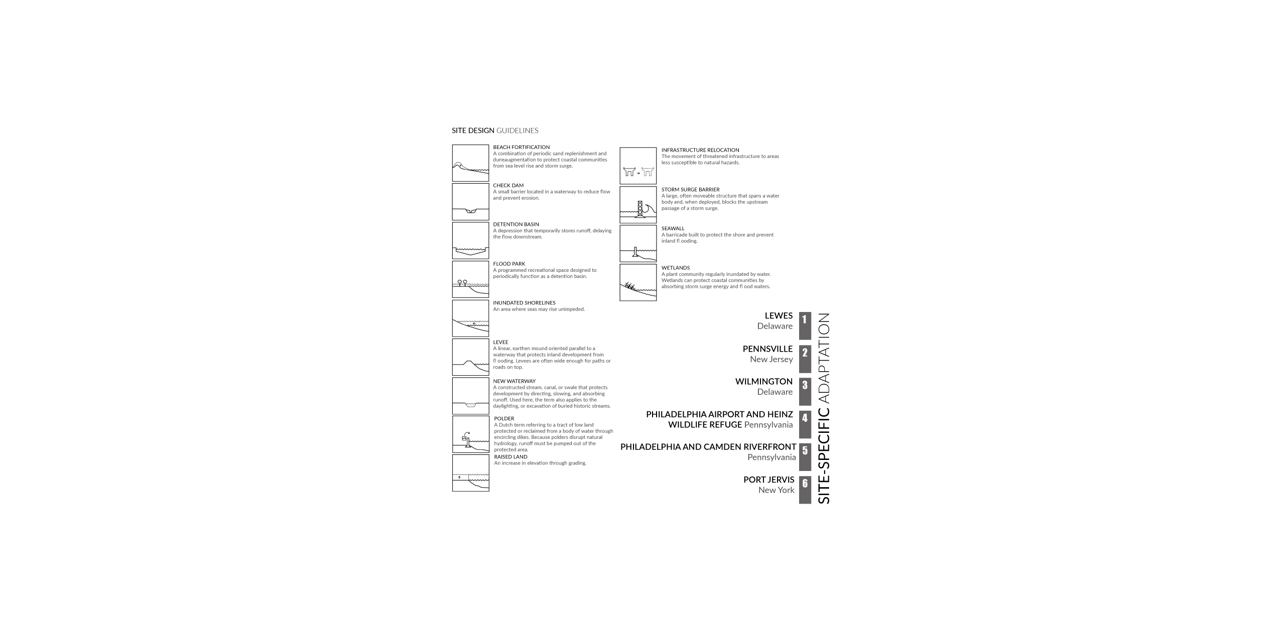
Nearly 8.5 million people lived within the boundaries of the Basin in 2000, and the population is projected to grow by 30 percent to 11 million by the year 2050. For the purposes of this study, the Basin was divided into three sections according to geography, settlement patterns, and land cover: Upper Delaware River Basin, Urbanized Area, and Lower Estuary. To understand the impacts of climate change on real people and real places, the studio identified six sites – some typical, some exceptional – that span the three sections of the Delaware River Basin:
LEWES, Delaware
PENNSVILLE, New Jersey
WILMINGTON, Delaware
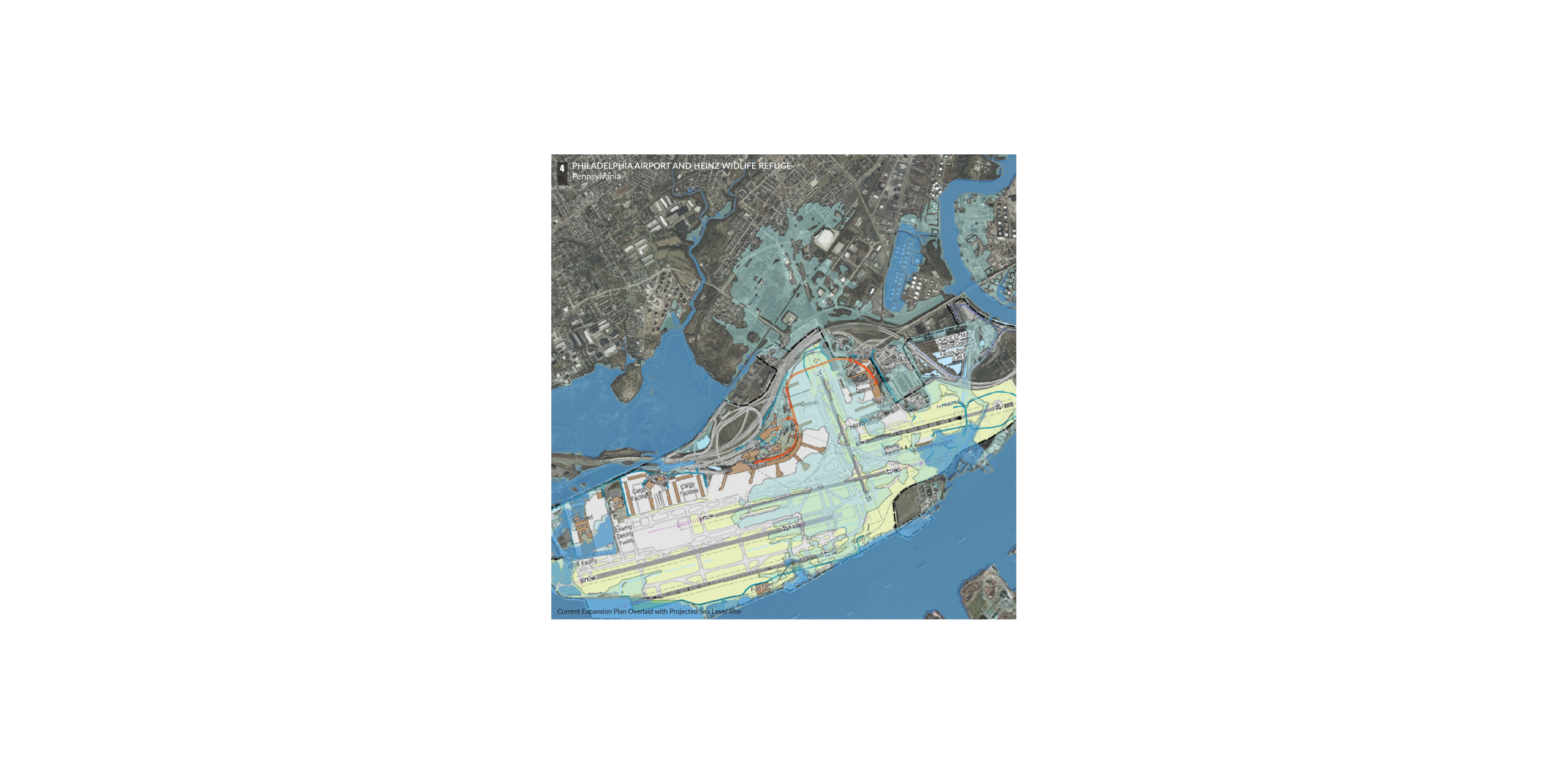
PHILADELPHIA AIRPORT AND HEINZ WILDLIFE REFUGE, Pennsylvania
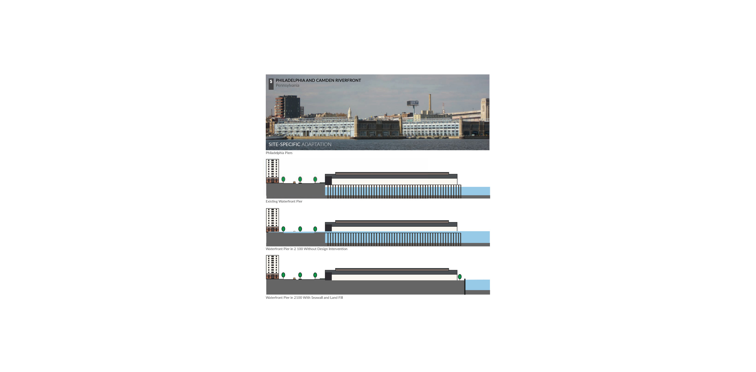
PHILADELPHIA AND CAMDEN RIVERFRONT, Pennsylvania
PORT JERVIS, New York
See more
RELATED CONTENT
